The Stairway to Kings Canyon, Watarrka – NT
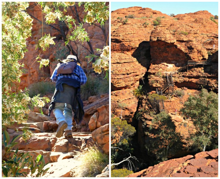
My head tilted back and my neck craned to follow the line of rugged rocky ‘steps’ rising steeply and unevenly towards the distant cobalt blue sky –
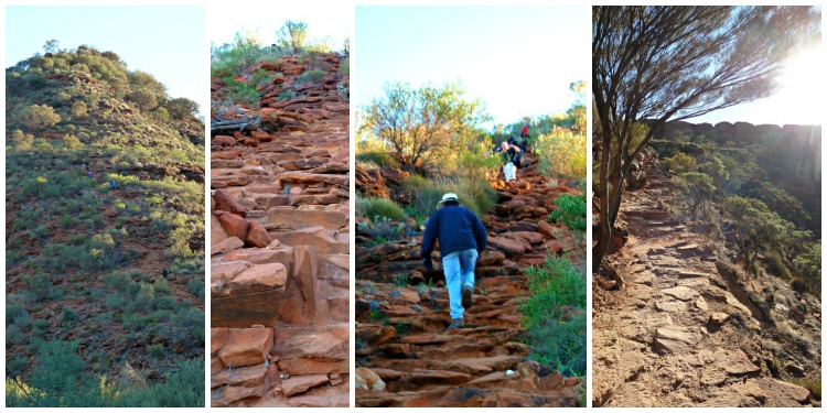
Can you spot the little blue specks in the left photo? They’re people making their ascent to get to the Rim of Kings Canyon…
There are approximately 500 “steps” to be surmounted to get to the top of Kings Canyon, (which is 465km/290miles by road SW of Alice Springs or 300 km/185miles NE of Uluru in Australia’s Red Centre) where the Rim Walk starts – but once there… you are taken on a magical 6 km (3.75 mile) circuit through ancient arid ‘bee-hive’ rock formations around the top of the Canyon – and then down into the contrasting hidden Garden of Eden.
For many, this ‘stairway’ appears to be too large a feat of endurance, so forms both the beginning and (sadly) the end of their expedition… And it does look a little daunting – but… slow and steady wins the race and as long as you don’t approach it with the mind of a Rock Wallaby, and gently climb just a few steps at a time, you’ll find yourself at the top in less than half an hour, and while I can’t quite say its all downhill from there, I can say you’ll be more than rewarded for your effort.
 When we set out, about 8am on this August morning, there was still a winter’s chill to the air – But don’t be fooled into believing its going to stay that way –
I recommend you carry twice as much water as you think you’ll need as whatever you think you’ll need, is rarely enough…
And up on the rim, as the sun rises to its pounding zenith, with the hard red rock reflecting the heat back up from beneath your feet, the dry desert atmosphere sucks the moisture from your body – even in the so called cooler months.
The Rock Domes on the Kings Canyon Rim Walk
Visually, my first impression of the bee-hive like domes on the top was their similarity to Purnululu (Bungle Bungles, WA).
At Kings Canyon, these sandstone rock formations give off a ‘Lost City’ feel having been formed from 20 million years of wind and rain erosion.

Having started out as cube shaped blocks bounded by intersecting cracks the weathering process has rounded off all the corners leaving these beautiful shaped domes interspersed by flat rock.
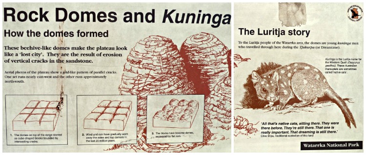 To the local Luritja people of the Watarrka National Park area the domes are Kuninga* men who travelled through here in the Tjukurpa (the Dreamtime).
*Kuninga is the Luritja name for the western quoll.
Cotterill’s Bridge
It’s not long before we reach our first diversion to Cotterill’s Bridge – It takes us across a chasm to a vantage point with spectacular views of the north wall.
Originally built by Jack Cotterill in 1962 of timber, slabs of sandstone and 8 gauge fencing wire, it collapsed in 1991 (remains can be viewed if you look down when crossing) so was replaced with this sturdier metal version –

The picture on the right was taken the next day from the Canyon floor –
Viewed from below it was amazing watching people cross what appeared such a precarious bridge!
The following day when we did the shorter Kings Creek walk we were able to see the bridge from the Canyon floor below – Looking up from the creek bed the bridge looked positively precarious as people crossed the chasm.
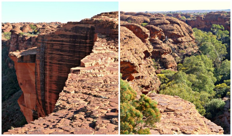
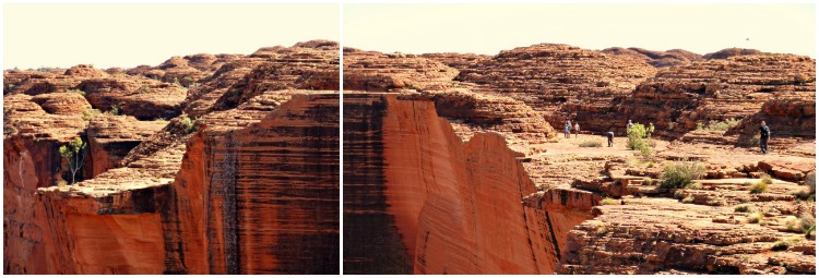
But from the top – It was beautiful looking out both ways – down the canyon (left hand photo below) to get a glimpse of the sheer edge that lay beneath our feet, and up the canyon (right hand photo) where you could see people starting the decent down the man-made steps that lead to the Garden of Eden.
Or simply looking out across the canyon to the north wall, from this stunning elevated platform.
The Garden of Eden
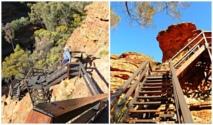
A series of wooden steps takes you back down to the Canyon floor…
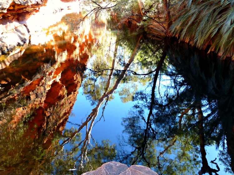
To the hidden Garden of Eden, where there’s a feeling of abundance as the water draws the wildlife into this microcosm.
Leaving the heat and the dry domes exposed to the sun on the top it was a treat to come down into this shady-glady oasis of water in Australia’s arid Red Centre.
To the Traditional Owners this is an important men’s sacred place, where their Tjukurpa (Dreaming) stories are too sensitive to share publicly. But the preciousness of this water source is highly respected by all so no swimming is permitted lest it get contaminated and endanger the hundreds of species that rely on its health and longevity for their survival.
I wish, as a global community, we could adopt their simple but oh so effective mantra:
“If you keep the water healthy, you keep the plants and animals healthy”
Kings Canyon – How it was Formed
But what goes down has to go back up!
And once back up on the top the views of the Canyon from the northern side seemed to get even bigger and better!
For those of a curious disposition –
This is how Kings Canyon was formed…
Although from this side, it looks as though a knife has sliced though it like butter 😉
The 6km (3.75 mile) Kings Canyon Rim Walk took us a little under 5 hours to complete – a bit more than the ‘official’ recommendation of 3 to 4 hours that we read in most information; but we took our time to wonder at the vistas, breath in the red centre air, admire the vegetation, observe the wildlife and occasionally just sit and ‘be’.
After making the effort to climb those 500 steps it was a place I was not going to rush 😉
It was a place that had long been on my bucket list –
And I’m happy to say, it didn’t disappoint 🙂
Do you have any places that have been on your bucket list forever… ?
Do share in the comments below 😀







Breathtaking! I had no knowledge of this amazing and unusual place. What a thorough account of your trek. Great photos too. I just found your site through the Boomer Travel Bloggers FB group. I’ll be back for a longer visit!
Thank you for dropping by Nancy –
Australia is a large country full of surprises 🙂
Breathtakingly beautiful!!
I absolutely loved it – but I am a sucker for the Red Centre 🙂
Judging by your photos, narrative and story map, this hike seems well worth the exertion. I don’t love heights, but I think I could manage the bridges and staircases as long as they have railings. (I did manage to handle the suspension bridges on the Milford Track in New Zealand). However, the photo with the white writing on it and the guy standing right next to the edge gives me heart palpitations. Does the trail go there or was he just being overly curious/daring/foolish?
I’d say he was “being overly curious/daring/foolish” LOL
The circuit takes you along the top, but its up to you how close to the edge you get!!
And yes, the exertion was well worth the effort – We went back to our camp with a big smile on our faces – very satisfying 🙂
I had never heard of King’s Canyon- thanks for sharing. It looks a lot like the American southwest- red rocks and amazing formations. Great photos.
I love this central area of Australia, which is why, maybe, I also have a hankering to visit the SW of America! 🙂
This looks fantastic and quite like Zion National Park in Utah, USA. There is a King’s Canyon in California as well. We once climbed 600+ stairs to the top of Vernal Falls in Yosemite National Park and while it proved to be utterly exhausting, the pay off at the top was well-worth the effort. Glad you can check 1 off of the bucket list.
Red, rugged, rocky regions have a huge pull for me!
And I’m pleased to know that as and when I do make it to the States the walk to the top of Vernal Falls in Yosemite NP is worth the hike!! 🙂
And now that we’ve visited Monument Valley and Arches National Park, I see similarities again! That beautiful red rock!
I read your wonderful post about visiting Arches in the snow!!!
The “Grand Circle” in the USA is certainly beckoning 🙂
This looks like an amazing place and I love the idea of finding a Garden of Eden in such seemingly hostile scenery. Your photos are so descriptive, but what I love the most? Well, I can’t help but being bowled over by your story maps. Just gorgeous.
Maybe it’s the strong contrasts of arid and verdant that amplifies the impression you get of each?
And thanks so much for the compliment re the Story-Map 🙂
Inspiring! I have not been to Kings Canyon but you have certainly made me put it on my ever increasing list of places to visit….and we don’t have to travel 24 hrs to see it! I agree with Jo…your sketch is fabulous!
I can highly recommend allocating a week to visit Uluru, Kata Tjuta and Kings Canyon to see, hike and experience some of Australia’s best landforms 🙂
And thank you re the Story-Map!
This hike looks fantastic — such beautiful scenery and interesting terrain in Kings Canyon. But I’m pretty sure you wouldn’t find me standing on the edge of one of those cliffs.
It was fantastic – and because the circuit is recommended to be walked anti-clockwise you feel fairly alone while doing it (as you’re all going the same way you don’t often pass someone else!)
And ditto – I believe in having a healthy respect for the dangers of nature 😉
Hi Linda,
It is the most amazing place. So glad you finally made it – it’s definitely worth the trip and why rush it? You did right to go slow and enjoy 🙂 Love the pic of you too.
Icing on the cake was I also did it on my birthday – Hence the birthday snap 😉
Nice article. We were in Kings Canyon about 2 years ago and your article brings back nice memories. Fortunately, it was reasonably cool the day we went and the colors of the area were vivid as ever.
I must say I was happy we did it in August – a so-called ‘cool’ time of year!
Otherwise – starting at dawn, and maybe carrying an umbrella for shade may have been the go?
I love the landscapes in this region of Australia – The RED of the centre really is magnificent 🙂
Pingback: How to Create the Illusion of Movement with Arrows in Your Travel Journal
That is a terrific article! We travelled from Melbourne up to the centre last year. The highlight always seems like it would be the rock itself, but Kings Canyon and everything made it such an awesome trip.
Jane Barnes recently posted..Sheepyard Flats – Overnight trip from Melbourne
While the Rock is the initial lure I agree – when you get there you discover that:
a) it’s not the only attraction, and
b) places like Kings Canyon, Kata Tjuta’s Valley of the Winds walk, and
c) the simple magic of being in the arid red centre where the desert oaks whistle in the wind
all vie for your attention and demand to be the top spot!
Hello Linda,
this post has been very usefull, expecially the Rim Walk sketch.
I’m back from my trip to Australia and I would like to link this page to a post I’m going to write on my blog.
Thank for sharing
Cheers from Italy
Simone
Simone recently posted..Vi racconto una foto: Lake Eacham by night!
Happy to hear you enjoyed the post – and my illustrated story map of the Rim Walk at Kings Canyon –
I did a story-map to illustrate everyday of that trip to the Northern Territory – You may also recognize one of the last ones into Jim Jim and Twin Falls – which I absolutely loved!
Here’s the link 🙂
woooo… the photos are amazing. the trek looks dangerous.. my husband is so scared of heights that he will never be able to climb even a small staircase. but i would surely like to experience this.
It was certainly easier going up facing into the side of the hill than it would have been coming down!
And because the walk is a circuit – happily we did not have to face that 😉
Some 35 years ago I crossed the original timber bridge (with a few heart palpations). Planning to return later this year (October) as it is my favourite Aussie landscape.
So agree re the landscape! The red centre is my favourite landscape too – Wild, open, rugged, so so red and such an amazing experience of connection to the country 🙂
Love reading your post. I’m 70yo and do have a bit of joint problems. Hubby and I have booked a Kings Canyon tour to climb and do the rim walk. My greatest concern is the 500 ‘steps’ climb up. Just wondering how difficult it is and whether it is doable for me
Hi Pat, The Kings Canyon Walk is wonderful! But I do understand your pre walk nerves re those first 500 ‘steps’ 🙂
As they zig zag a little you can do a few steps and then stop to turn around to see how far you’ve gone and then do a few more – it really is like eating an elephant, just one bite at a time –
There are a few more sets of stairs once you get to the top, but again… slow and steady –
I usually double the estimated time they say for these kinds of walks – Particularly if you want to have a picnic lunch at the Garden of Eden where you can sit by the water –
Depending on when you are going to do it avoid the heat of the day – so getting up at dawn may not sound too enticing but you’ll be so pleased you did 😉